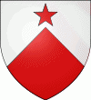
Ħal Għargħur (Ħal Għargħur)
 |
 |
In Malta, each village celebrates a different patron saint or two depending on the number of churches in the locality. Each church is dedicated to a different saint. For this reason, some villages celebrate more than one "festa" per year. The village band clubs, at times in collaboration with the members of the parish, are tasked with the organisation of the "festa". The competition between the band clubs can be quite fierce when it comes to the organisation of decorations and the fireworks shows, even if there is only one "festa" in the village. It gets even tougher when the locality celebrates two different patron saints, each honoured by an individual band club. The "festi" are held over the summer months. This is a time of great merrymaking for the local community. In fact, there are a lot of traditions and customs associated with the "festa". Attending the "festa" can be a bit of a culture shock as it can get really noisy and loud. The Għargħur Festa is on the twenty-fourth August or the last Sunday of August. For a whole week, Għargħur enjoys a celebratory festive mood, as it is wholly decorated in colourful lights, statues and other street decorations. The brass band marches take place throughout the evenings on the days prior to the "festa", accompanied by spectacular fireworks, together with the nougat and ice cream stalls distributed around the village. On the day of the feast of St. Bartholomew, there is a procession around Għargħur with the titular statue of the saint followed by brass bands and a crowd of devout ones.
Map - Ħal Għargħur (Ħal Għargħur)
Map


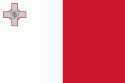
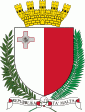
Country - Malta
 |
 |
| Flag of Malta | |
Malta has been inhabited since approximately 5900 BC. Its location in the centre of the Mediterranean has historically given it great strategic importance as a naval base, with a succession of powers having contested and ruled the islands, including the Phoenicians and Carthaginians, Romans, Greeks, Arabs, Normans, Aragonese, Knights of St. John, French, and British, amongst others.
Currency / Language
| ISO | Currency | Symbol | Significant figures |
|---|---|---|---|
| EUR | Euro | € | 2 |
| ISO | Language |
|---|---|
| EN | English language |
| MT | Maltese language |
